 Webcam
 Weather
 Lifts
Lifts Bike Trail
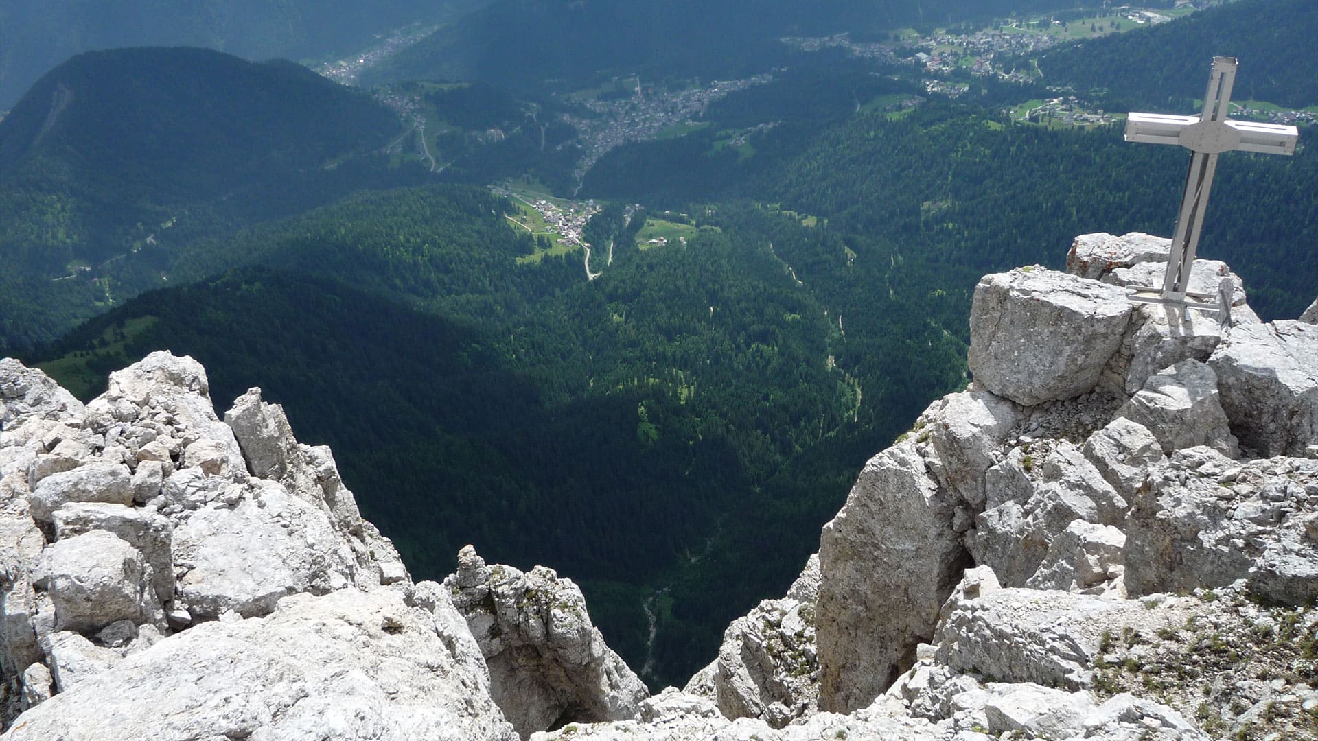
Great war trekking routes: trekking in the Dolomites along the historical routes of the Great War
Walking routes through the settings of the First World War
The Val del Biois and the Dolomites that surround it were the scene of bitter battles between the Italian and Austrian troops during the First World War, and numerous traces remain here testifying to this important, violent period in history, guarded with the greatest respect by our “Pale Mountains”.
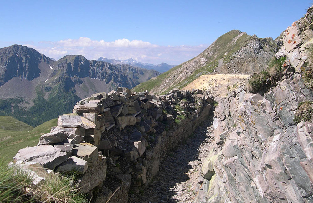
ALTA VIA DEI MONZONI
San Pellegrino Pass (Costabella Chairlift) in Fango (San Pellegrino Valley)
About the history…
The wartime events that unfolded in this sector of the Dolomite front were the result of the strategic importance of the mountain chain, because conquering the “Monzoni – Costabella” line would have allowed the Italian troops to make their way into Val di Fassa and Moena, upsetting the strategic defence plans of the Austrians.
Cima Alochet was conquered by the Bersaglieri Corps on 18 June 1915, but was immediately abandoned under furious fire from an Austrian machine gun positioned on a peak in front of it (Punta dell’Ort). The Italian troops then moved into the trenches and positions below the “Colifon”, where they remained until early November 1917, when, following the battle of Caporetto, they were forced to abandon this front and retreat to the Piave River.
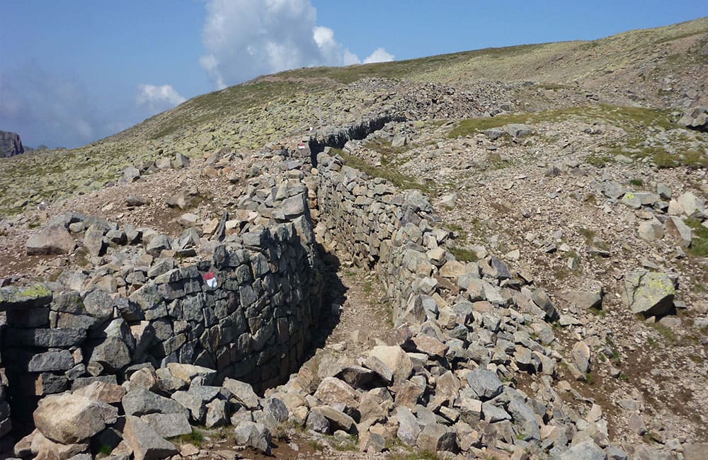
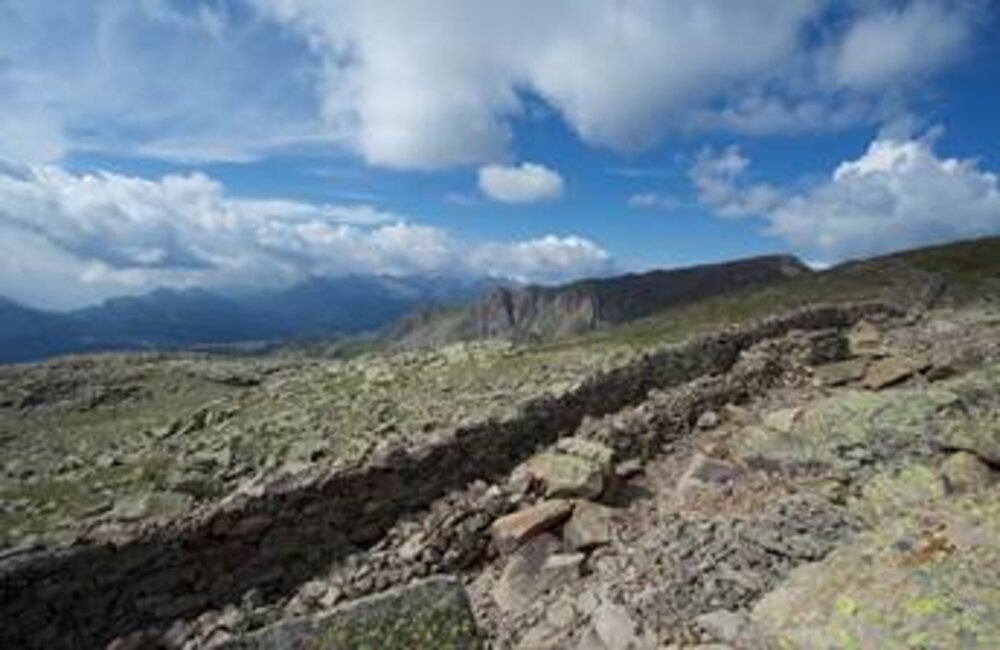
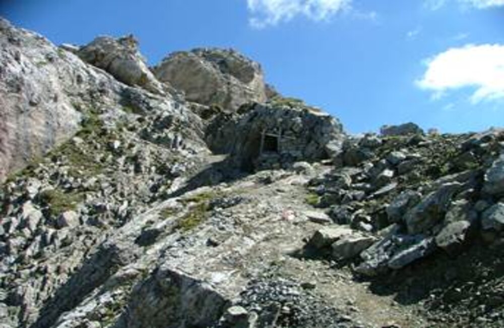
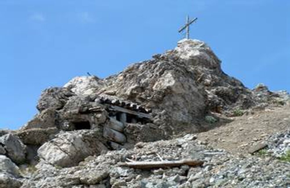
Right along the ridge, until Cima Ricoleta, you can still see numerous remains of this wartime activity: shelters, embrasures, trenches, the foundations of huts, iron structures set into the rock…and on the final stretch, you can visit the ruins of the Austrian Zigolade lookout point.
The beauty of the Dolomites…
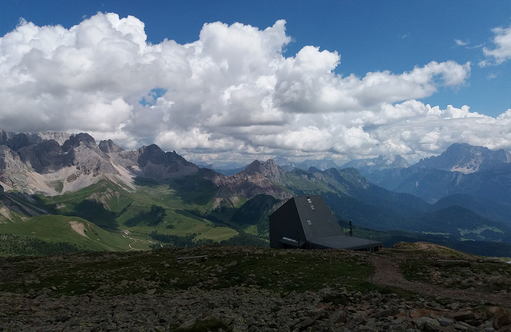
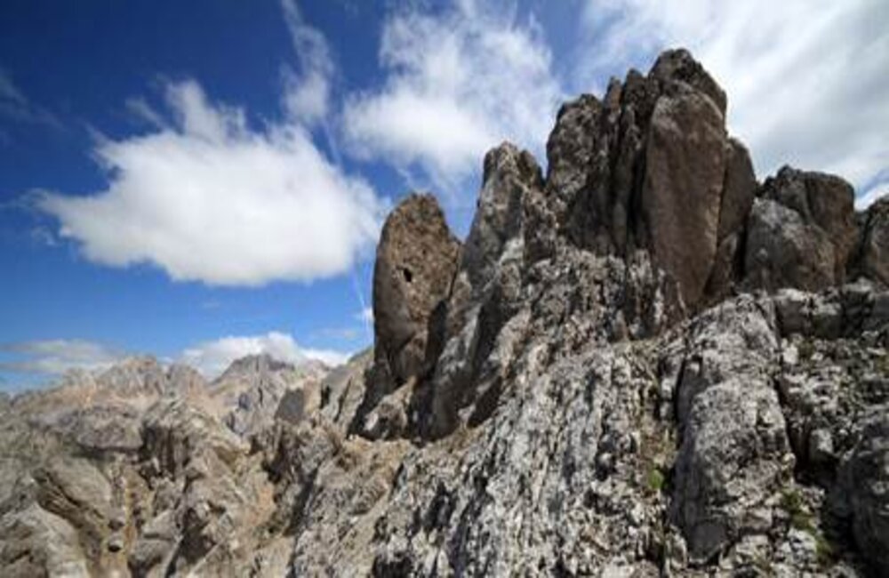
Along the way, make sure you stop off for a bit to admire the marvellous view over the mountain chain of the Cimon di Bocche, Lagorai, Latemar, Catinaccio and Pale di San Martino.
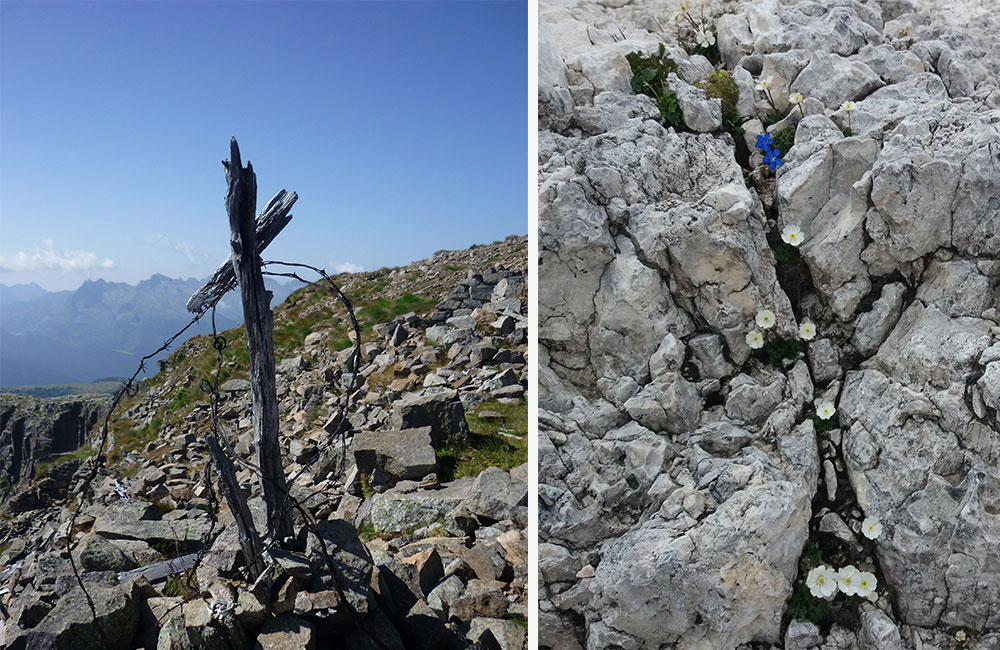
During June and July, nature springs colourfully to life on the Monzoni ridge, thanks to the flowers in bloom all over the fields below.
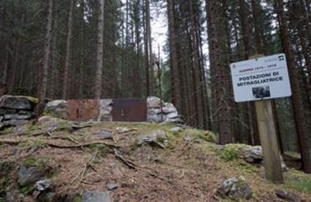
THE FANCH TRENCHES
Round-trip route in the San Pellegrino Valley
About the history…
Fanch (Fango), near the San Pellegrino Pass, was the location of the second, and strongest, Austrian defence line, also known as the resistance line and linked to the two main high-altitude outposts of Costabella and Cima Bocche.
It consisted of a system of skilfully constructed trenches, equipped with rifle and machine gun emplacements. Right next to the trenches, which climbed up both sides of the valley for a long stretch, shelters were built for the soldiers, as well as storage facilities for a variety of supplies.
The cart road for the San Pellegrino pass had been interrupted at Fanch, so porters had to carry supplies up on foot to the high-altitude front as far as the Selle Pass.
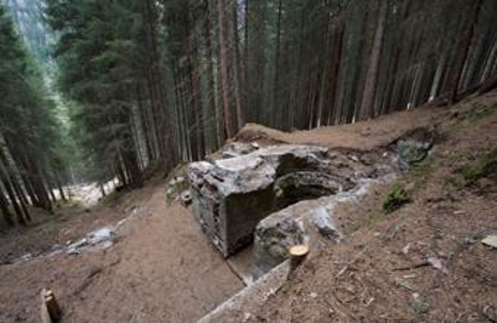
About a kilometre further east from Fanch were the front line trenches. These are no longer visible today, because they were buried in the 1920s so that animal fodder could be grown once again in the fields. However, near “Toal de Ricoleta”, on the north side of the main valley, a tunnel has been identified that would appear to have been part of this front line.
The beauty of the Dolomites…
A point offering interesting views out towards the San Pellegrino Valley and the peaks of Juribrutto, Cima Bocche and Gronton.
Along the route between Fanch and the Ricoletta Gallery, you can admire some magnificent, centuries-old fir and larch trees.
Fango village (San Pellegrino Valley)
Fango Village (San Pellegrino Valley) – Round-trip route 1643m
2h 30m
Maximum altitude 1823m – altitude difference 180m
Easy (possible even with uncertain weather)
Trekking equipment; a torch is essential in the tunnel.
COL MARGHERITA
Round-trip route on the San Pellegrino Pass
About history…
The Col Margherita – Juribrutto area was of vital importance for the advance of the Italian troops in this part of the front, and the peaks were the scene of bitter fighting and bloody attacks. The most violent battles took place beyond the Forcella Juribrutto saddle, on the south ridge of Cima Bocche, where the Italian soldiers of the Tevere Brigade fought the Austro-Hungarian troops.
None of these actions by the Italians were actually aimed at opening up a passage towards the Fiemme Valley; they were a mere distraction designed to prevent the movement of the Austrian troops on the Isonzo front.
This move provided further confirmation of the bitterly criticised contempt for human life on the part of the high command, which stubbornly insisted on fighting for positions they had absolutely no chance of conquering.
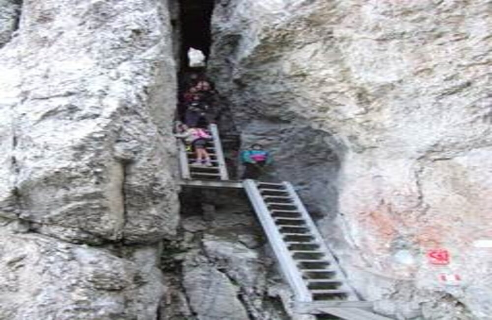
The area is well preserved on the ridge and on the Juribrutto peak, while on the final “Col de le Palue” stretch, you can visit the Italian war tunnels, which have recently been restored.
The beauty of the Dolomites…
Take a deep breath, recharge your batteries and admire the marvellous view over the Pale di San Martino, Lagorai, Latemar, Catinaccio, Sassolungo, Creste dei Monzoni/Costabella, Marmolada, Pelmo and Civetta.
Variant…
A variant to this route can be followed by walking up to Cima Bocche (2745 m), and then, from the Forcella Juribrutto saddle, continuing along path no. 628. Time required 1h and 15mins if you choose this alternative route.
S.Pellegrino Pass (Col Margherita cableway) 1918m
Passo S.Pellegrino – (Malga)
4h 30m (with Cima Juribrutto cableway 5h 30m), not using the cableway lengthens the route by 2 hours.
Max. altitude 2691 m – altitude difference 720 m (with the climb up to Cima Juribrutto 820 m), of which 650 m by cableway.
Medium
High-mountain equipment, safety cord, helmet and torch to visit the Col de le Palue tunnels
CRESTE DI COSTABELLA
Round-trip route on the San Pellegrino Pass
About history…
May 1915 saw the first incursions of the Italian troops into what was then Austrian territory, amid the extensive grassland of the San Pellegrino Pass. The Austrians, however, were stationed just beyond the San Pellegrino Pass and on the Selle Pass above it, where they had built a little village,
which prevented any chance of the Italians advancing towards the Val di Fassa.
The battles between the two armies then moved to the Costabella ridges, where a great deal of blood was shed, and the border shifted back and forth, with ground being gained by the Italians and then after a few days lost again to the Austrian troops. Especially memorable was the battle of March 1917, to gain possession of the Cima Costabella peak, during which tonnes of bullets and grenades rained down on the Italian soldiers protecting their positions, with devastating effects.
At the end of October 1917, the Austrians broke through the Isonzo front, the Dolomite front was abandoned, and peace and silence were returned to these mountains. The area remains well preserved to this day, with caves, trenches, military positions, foundations and huts. Along the initial stretch, still visible is the original dormitory of the Austrian “KAISERSCHÜTZEN” regiments, and on the final stretch, you can visit the Italian lookout post, inside which is the permanent exhibition “Guerra alla Guerra” (Waging War on War).
The exhibition is composed of a series of panels brought up here in summer 2005, featuring a collection of photographs of the German anarchist Ernst Friedrich, published for the first time in 1924 to illustrate the horrors of war. Destruction, common graves, executions and battlefields devastated by the artillery are depicted in all their raw cruelty.
The beauty of the Dolomites…
Along the route, you can enjoy splendid views across the Catinaccio, Sassolungo, Sella, Pordoi, Marmolada, Pale di San Martino, Civetta and Pelmo mountains.
S.Pellegrino Pass
S.Pellegrino Pass – Costabella chairlift
5h (3h for the half of the route that runs along path 604/a). If you choose not to use the chairlift, it will take you approximately another 50 minutes
Max altitude 2759m
Medium
Equipment required: high-mountain equipment, safety cord, helmet and torch
CIMA BOCCHE
Round-trip route on the San Pellegrino Pass
About history…
The Austro-Hungarian front line cut across the Travignolo Valley just upstream from Paneveggio, before climbing back up the opposite side to Cima Bocche. The Cima Bocche area played a pivotal role in the Austrian defence in this part of the front. In 1915, huge amounts of troops were packed on the peaks, and the cost of sustaining this effort – in terms of technique and the difficulty of creating and maintaining liveable conditions in all seasons – became incalculable.
The construction of cableways brought great relief to the endless columns of porters, but they could only go so far, and the porters were still compelled to carry supplies on their shoulders or load them on mules to reach some places.
In 1916, after a particularly harsh winter, with heavy snow, which caused numerous victims, many of whom were killed in avalanches in the spring, the battle began for the control of Cima Bocche. As dawn broke on 20 July 1916, the first battalion of the Tevere Brigade launched a surprise action that took them right up to the Austrian lines, but the reaction of the Austrian troops was such that the Italians were forced to fall back, although they remained close to the enemy positions. The fighting lasted all summer, until the final action on 3 November 1916, when the Italian army – which had already lost some 2000 men – managed to conquer a strategic point known as the “lookout point”, and to maintain control of it for a short time. The Austrians fought back, leaving 200 dead on the battlefield in front of the fallen positions, and after 5 days of fierce, continuous battles, succeeded in regaining control of the outpost.
Right along the Cima Bocche ridge and the Gronton equipped path, you can see numerous remains of the wartime action, bearing silent witness to the events of the period: trenches, emplacements, communication trenches, steps and the foundations of huts.
The beauty of the Dolomites…
The magnificent peaks of the Lagorai, Pale di San Martino, Latemar, Catinaccio, Sassolungo, Monzoni, Creste di Costabella and Marmolada accompany you all the way along the route.
Variante di percorso…
You can also follow this itinerary in reverse, walking up from Fanch (Fango) and continuing along the “Gronton – Cima Bocche” equipped path (time required 4h30mins). Time required to return to the station upstream from the Alpe Lusia lifts 3h. If you choose not to use the lift facility, the route will take approximately another 2 hours.
Altitude difference 1300 m.
Mountain station Alpe Lusia – locality Le Cune 2200m
Fango village (San Pellegrino valley) 1643m
3h to Cimon di Bocche (3h45mins with the Gronton equipped path variant). 3h30mins to return to Fanch along paths 634 and 625
Max altitude 2745m
Medium
High-mountain equipment (safety cord and helmet only on the Gronton equipped path)