 Webcam
 Weather
 Lifts
Lifts Bike Trail
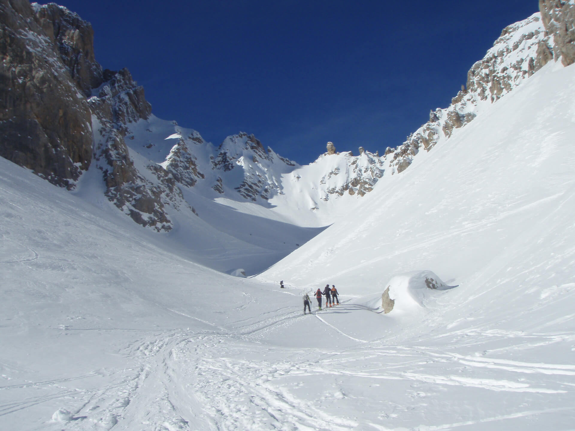
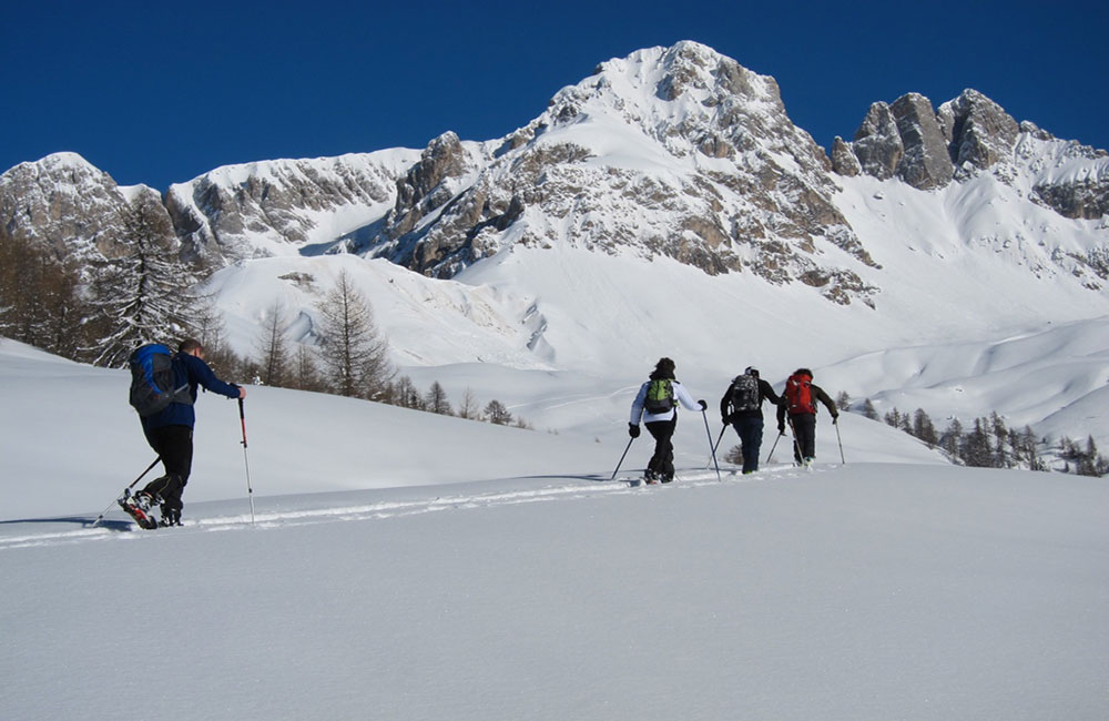
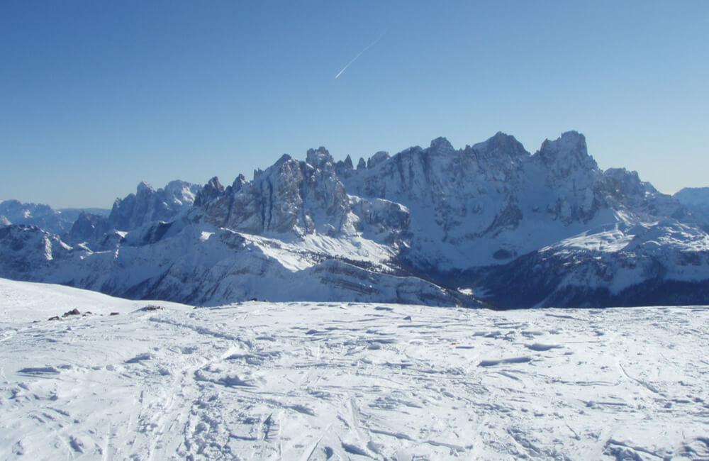
Forca Rossa Pass
From the South via the Valfreda
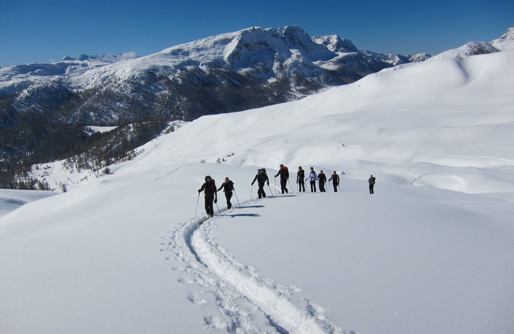
One of the great ski mountaineering classics, this easy route is suitable even for skiers of average level, and can be tackled throughout the winter, thanks to the favourable exposure to the sun and the absence of steep slopes.
Departure and arrival: road for the Baita Flora mountain hut (1850 m), parking area just after the bridge over the Rio Zigolè Stream.
Description: from the parking area, take the forest road on the left for Casoni di Valfréda, and after about a hundred metres, go up on the left along a former ski run until you come out of the woods with Fuciade in sight. Keeping slightly to the right, uneven ground will take you to the ridge that separates Fuciade and Valfreda. Go along the ridge until you come close to a structure serving an aqueduct. Go diagonally across the slope on the Valfreda side until you come to a large sloping plateau that goes up northwards to the lower edge of a moraine. Then turn sharply eastwards, along the edge of the moraine, until you reach the edge of the precipitous cirque walls of the Marmolade. Remaining close to the edge, go back up towards the north-east, and a final, steeper slope will take you to the Forca Rossa Pass (2499 m). To descend, proceed back down along the ascent route. A number of different variants are possible towards Casoni di Valfreda, but they involve steeper slopes.
South Southwest
1-2 hours
Medium Skier
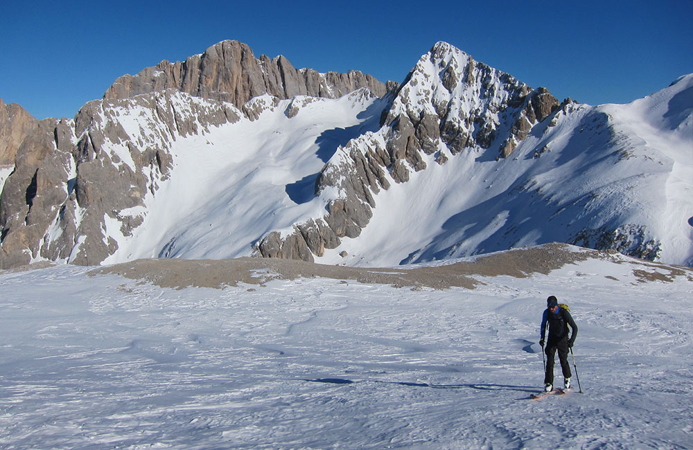
Cirelle Pass
From Fuciade
Very popular ski mountaineering route, thanks to the easy access and the interesting descent for skiers, requiring a good technical level. Possibility to extend the route with a climb up to Cime Cadine.
Departure and arrival: Description: towards the north, follow the generally groomed run that leads to the Fuciade Refuge. Just before the Refuge, come off the run and continue left along a large, even slope with a moderate gradient. Where the ground starts to become steeper, go diagonally up across the south-eastern slopes of the Sass di Tasca until a marked projection under Punta Zigolè. Then take eastwards towards the Val di Tasca, and go along it until the ledge below the northern faces of the Sass di Tasca; go back up a steep slope to the right until you come onto a rocky bank in a steep valley, along which you can climb back up in a zig-zag pattern to the Cirelle Pass (2863 m). To descend, proceed back down along the ascent route.
2-3 hours
Good Alpine Skier
South
Knives or crampons in the presence of frozen snow.
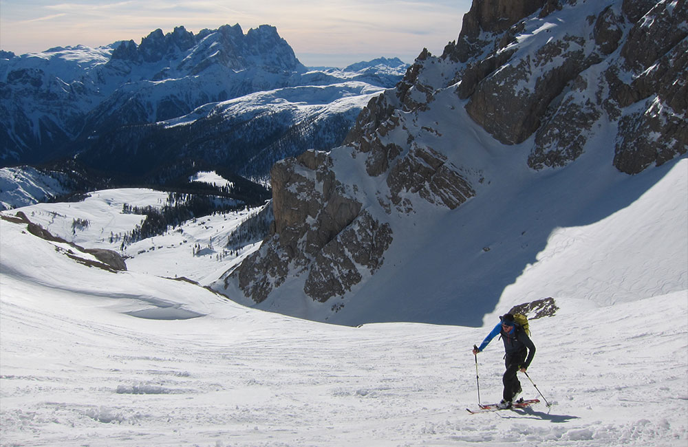
Monte Mulaz
Traverse with a descent along the Focobon Valley
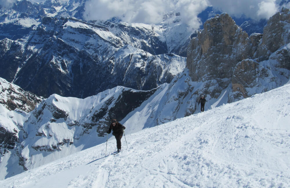
The Mulàz is one of the most interesting peaks in the western Alps for skiers, especially for the challenging descents on the north-eastern face. The traverse from the Val Venegia to Falcade with descent along the Focobon Valley, described here, is a classic itinerary that offers particular satisfaction, in terms of both the scenery and the beauty of the descent, which does, however, require technical skill and a good level of training.
Departure: parking area at the head of the Val Venegia (1675 m), which can be reached from along the S.P. 25 provincial road, about 4 km after the Valles Pass on the Predazzo side.
Arrival: Falcade, Molino area (1200 m)
Description of the ascent: from the parking area, go along the forest road on the valley bottom, which is generally groomed, for about 5 km, until you reach Pian della Vezzana. Leave on your right the road that continues towards the Baita Segantini mountain hut, and go up along the broad valley that separates the Mulàz massif from the northern Pale chain, until you reach the Mulàz Pass (2619 m). Take slightly south and go up the steep slope until you reach a saddle at an altitude of 2750 m; proceed right in an easterly direction right across the south face until you reach the south-east shoulder, from which you can quickly reach the peak of the Mulàz (2906 m)
Description of the descent: from the peak, take the same route back down in the opposite direction to the Mulàz Pass: From the pass, instead of going down the west face along the ascent route, go down the north-east face on the Val Biois side, which will soon take you to the Mulàz Refuge (2571 m). From here, proceed along the moraine slopes that characterise the northern face of the Cime di Focobon, along which, without following a compulsory route and going around the edge of the Campanili dei Lastei, you will reach the broad rock face above Casera Focobon. When you come almost to the base of the rock face, keeping to the orographic right, go along a stretch with a gentle slope that leads to the start of the channel along which the Focobon stream runs, which becomes gradually narrower and more uneven (the difficulty of this stretch depends on the conditions of the snow and the mounds formed by avalanches). At the mouth of the channel, moving towards the orographic right, take a forest road, which, along a fixed path, takes you to Molino di Falcade.
Cima Juribrutto Peak
from the Malga Vallazza alpine hut
A classic, popular ski mountaineering peak, suitable even for skiers with a medium level of ability.
Departure and arrival:Malga Vallazza (1935 m), about 1 km after the Valles Pass on the Predazzo side.
Description: from the alpine hut, go up northwards on moderately steep ground through a sparse group of Swiss pine trees to a shelf at the edge of the woods (trace of the path always almost visible). Keep to the orographic right and take the shallow Rif di Pradazzo valley until you come to another shelf, on a rise, from where you can glimpse the possibility of climbing up easily along the left slope. Go up the slope until you cross to the right onto the broad southern face of the Cima Juribrutto peak (Laste di Juribrutto). Go round a promontory on the left and up a moderately steep slope, initially moving towards the right, towards the eastern edge of the Laste, and then take left again onto the broad, slightly inclined slope of the summit. Proceed northwards (take care not to take the wrong direction in the event of fog) until you reach the Cima Juribrutto peak (2697 m). To descend, proceed back down along the ascent route.
1,5-2 hours
Medium Skier
South
Knives or crampons in the presence of frozen snow.
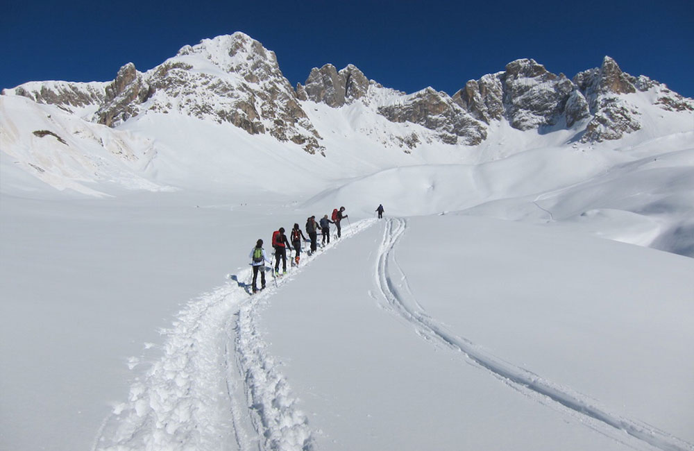
Forcella Val Tasca saddle
A splendid, easy route. An excellent alternative to Forca Rossa.
Departure and arrival: Departure and arrival: Road for the Baita Flora Alpina mountain hut, at the bridge over the Rio Zigolè stream.
Description:Proceed northwards along the generally groomed run that leads to the Fuciade Refuge. Come off the run just before the refuge and continue left towards the north, remaining on the orographic right of the Rio Zigolè stream. Where the ground starts to get steeper, go diagonally up across the south-eastern slopes of the Sass de Tasca until you reach a pronounced relief under Punta Zigolè. Proceed westwards into the Val di Tasca and continue towards the head of the valley, closed off by a ridge of pinnacles. Clearly visible in the centre are two channels; take the one on the left, which, doubling back a few times, leads to the saddle of the Val Tasca. Alternatively, you can take the one on the right to the pinnacle of the ridge.
2-3 hours
Medium Alpine Skier
Southeast
Cima Bocche peak
from the North
With its relatively brief, but always interesting upper slopes, this is a classic, extremely satisfying, medium-difficulty route..
Departure and arrival: going down three kilometres from the San Pellegrino Pass to Moena, park on the left at the Malga Negritella alpine hut.
Description: proceeding southwards from the Negritella Hotel, cut across the Nordic ski run to Malga Campo d’Orso. Keeping to the orographic right of the Rio Campo d’Orso stream, proceed along an initially fairly steep stretch of woodland to a plateau from where you can clearly see the Forcella di Bocche saddle (on the right) and the Forcella di Juribrutto saddle (on the left). Go up the last stretch of woodland, doubling back a few times, after which you will come out onto open ground and enter the broad valley that leads to the Forcella di Bocche saddle (2543 m). From the saddle, proceed on left up towards the east to the crest with rocky outcrops up to the peak.
2-3 hours
Good Alpine Skier
Northwest
Forca Rossa traverse
arrival Malga Ciapela alpine hut
Departure:road for the Baita Flora Alpina mountain hut (1850 m), parking area just after the bridge over the Rio Zigolè stream.
Arrival: Malga Ciapela
Description: from the parking area, take the forest road on the left for Casoni di Valfreda; after about 100 metres, go up left along a former Nordic ski run until you come out of the woods. Keeping slightly to the right, uneven ground will take you to the ridge that separates Fuciade and Valfreda. Go along the ridge until you come close to a structure serving an aqueduct. Go diagonally across the slope on the Valfreda side until you come to a large sloping plateau that goes up northwards to the lower edge of a moraine. Then turn sharply eastwards, along the edge of the moraine, until you reach the edge of the precipitous cirque walls of the Marmolade. Remaining close to the edge, go back up towards the north-east, and a final, steeper slope will take you to the Forca Rossa Pass (2499 m).
From the pass, going down from the opposite side, briefly cross towards the left onto the north-eastern slope of Monte la Banca. A pleasant ski, keeping to the orographic left, will take you towards Malga Franzedas, and from here, follow the mountain pasture road that soon leads to Malga Ciapela.
1000 m.
4-5 hours
Medium Alpine Skier
South, southwest. Northest