

logo

Proin gravida nibh vel velit auctor aliquet. Aenean sollic itudin, lorem quis bibendum auctornisi elit consequat ipsum, nec nibh id elit. Lorem ipsum dolor.

Latest Posts
Top
  • Eksplorasi Teknologi
  • WordPress CMS Checker
  • Trekking Falcade Valfredda

    Hikes and Via Ferrata routes

    FALCADE TREKKING

    LA CAVALERA – FALCADE, CAVIOLA, CANALE D’AGORDO

    Easy walk

    Start your walk from “Piana di Falcade”, a wide meadow in the heart of Falcade, near the small lake. This pleasant route follows the Biois Stream and takes about 1 hour to reach Canale d’Agordo. The trail is flat and suitable for all ages, making it an ideal choice for families with children.

    Don’t miss: The Via Crucis, created by the artist Franco Murer, dedicated to the “Smiling Pope”.

    Falcade Plain

    Canale d’Agordo

    4,5 km

    1 hour and 15 minutes (one-way)

    Suitable technical clothing and hiking boots

    GIRO DELLE COSTE

    Easy walk

    Start this classic loop trail in the centre of Falcade. Follow Via Veneto and Via 7° Alpini, then climb from Piazza Col De Rif to Falcade Alto along trail n. 5. Continue on the Somor Trail (n.1) towards Le Coste, enjoying beautiful views along the way. From Le Coste, descend along the road to Via Venezia, then follow trail n.17 to return to the starting point. The route is well-marked throughout and passes through forests and charming mountain.

    Don’t miss: the characteristic tabià – traditional barns built of wood and stone.

    Piazza Municipio, Falcade

    Piazza Municipio, Falcade

    5 km

    2 hours

    Suitable technical clothing and hiking boots

    SAPPADE-JORE

    Easy walk

    Start from the hamlet of Sappade (1350m) and follow Trail n.692. After an initial steeper section, the path continues more gently through the forest, offering occasional panoramic views along the way. In about 1 hour, you’ll reach Maso di Jore, a charming settlement featuring a small chapel, a traditional bread oven, and the caretaker’s house. You can return via a loop path back to Sappade.

    Don’t miss: the little church of Jore, built in 1858 and restored to its former glory after the war.

    MARMOLADA-BAREZZE WATERFALL-MALGA BOSCH BRUSA

    Easy walk to the waterfall, medium to the mountain hut

    Start from the hamlet of Marmolada (1240m) and follow the Geological Trail. The route runs along the right bank of the Gaon stream on a well-marked and well-trodden path with information panels. You’ll reach the hamlet of Valt and, further on, the Barezze Waterfall.

    Optional continuation (medium difficulty): from the waterfall you can continue along CAI Trail n. 631, a more challenging route that leads to Malga Bosch Brusà (1867m). The hike is about 2 km long and takes approximately one hour and twenty minutes.

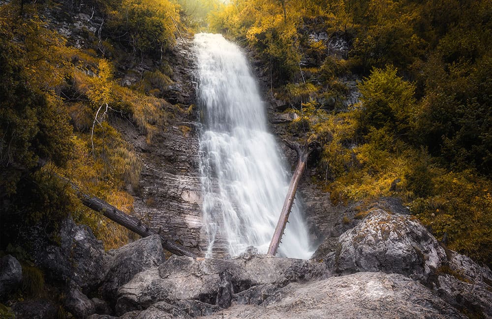
    Don’t miss: the Barezze Waterfall – one of the area’s finest natural treasures.

    Hamlet of Marmolada

    Barezze Waterfall (optional continuation Malga Bosch Brusà)

    2 km to the waterfall, 4 km to the mountain hut

    1 hour and 10 minutes to the waterfall, 2 hours and 30 minutes to the mountain hut (one-way)

    Easy to the waterfall, medium to the mountain hut

    250m to the waterfall, 690m to the mountain hut

    Suitable technical clothing and hiking boots

    VALLES PASS-LARESEI REFUGE

    Easy walk

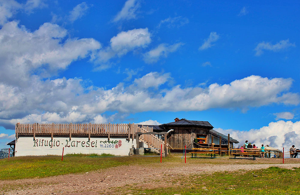
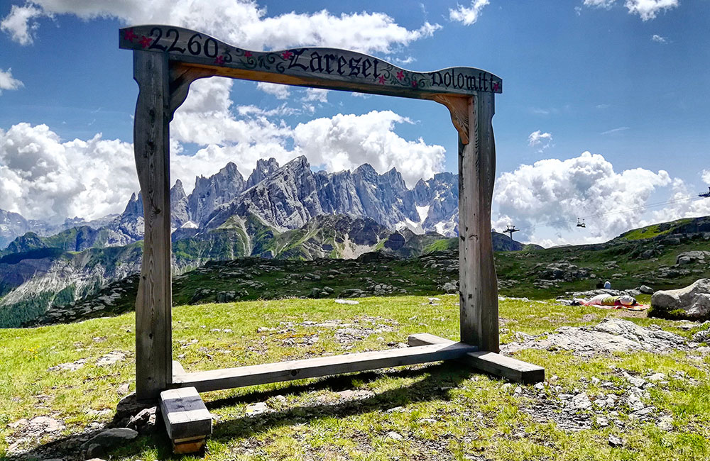
    Start from the parking area at Passo Valles (about 2030m). Take Trail n. 658 on the right, a wide and well-marked dirt road that leads to Rifugio Laresei (2250m). The route stays entirely above the tree line, offering open, panoramic landscapes. While some sections can be slightly steeper, overall the hike is easy and suitable for children, who will love spotting grazing cows and horses along the way. From the hut, you can continue towards Lake Cavia and Col Margherita.

    Don’t miss: the spectacular panorama – a natural terrace overlooking the Dolomites.

     Parking area at Valles Pass

     Laresei Refuge

    3,5 km

    1 hour and 30 minutes (one-way)

    Suitable technical clothing, hiking boots, cap, sunglasses and sun cream

    MOLINO-BOTTARI REFUGE

    Easy-medium walk

    Start from Camping Eden in the Molino area (1100m). The route mainly follows a well-marked forest trail with a steady uphill climb and an elevation gain of 373 meters. This makes it slightly challenging yes suitable for hikers with a basic level of fitness. In about 1 hour and 15 minutes, you’ll reach Rifugio Bottari (1573m), a small and welcoming mountain hut managed by the CAI Oderzo. If you wish to extend the hike, you can continue towards Malga Valles Basso (1771m) and then return to Molino to complete a pleasant loop itinerary.

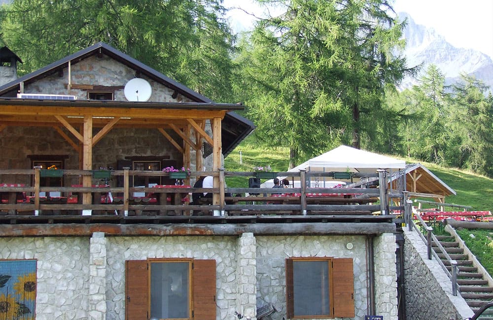
    Don’t miss: a relaxing break on the terrace of Rifugio Bottari, open in the summer season.

    Eden Campsite, Molino

    Bottari Refuge

    2 km

    1 hour and 15 minutes (one-way)

    Easy-medium

    Suitable technical clothing and hiking boots

    DOLOMITI IN MINIATURA

    Easy-medium walk

    This family-friendly loop trail starts from the centre of San Tomaso Agordino, in the hamlet of Celat. After crossing the village, the route enters the forest and follows a rural track. The first section is slightly uphill; then the trail becomes gentler and more enjoyable – ideal for families with children who are accustomed to walking. Along the way you’ll find 19 stone sculptures inspired by the Dolomites, making the walk fun and engaging for kids.

    Don’t miss: taking a photo in front of the sculpture of Monte Civetta, with the real mountain framing the background.

    Hamlet of Celat, San Tomaso Agordino

    Hamlet of Celat, San Tomaso Agordino

    5,3 km

    2 hours and 30 minutes

    Easy-medium

    Suitable technical clothing and hiking boots

    COL DE FRENA WALK

    Easy-medium walk

    This circular route takes you around Col de Frena through the villages of Carfon, Fregona, Feder and Vallada, which are linked by ancient paths and mule tracks. Tre trail passes through the conifer woods, where you can still feel the authentic mountain atmosphere of times gone by. From Caviola, continue through the woods to Fregona, then follow a path to Carfon. From here, head down towards Vallada Agordina, passing the charming village of Cogul, which boasts one of the finest views of Monte Civetta. Continue on up towards the Lagazzon Saddle, the starting point for hikes towards the Cime d’Auta. From here, follow the route back to Caviola to complete the loop.

    Don’t miss: the characteristic tabià in Cogul (traditional barns linked to ancient crafts) and the Alpine architecture that tells you story of the local heritage.

    Caviola

    Caviola

    7 km

    2 hours and 30 minutes

    Easy-medium

    Suitable technical clothing and hiking boots

    CANALE D’AGORDO-GARES

    Easy-medium walk

    Start from the square in Canale d’Agordo and head towards Piazzetta di Tancon. After the cemetery, cross the bridge over the Liera stream and take the dirt road on the right. Continue along the left bank of the stream through fir and larch woods, passing Prade, Campiòn and Pian de Sabiòn, until you reach the parking area of the Gares Biotope. The route is suitable for everyone and can also be explored by bike. It’s mostly flat with short uphill sections, though moderately difficult due to its overall length.

    Don’t miss: a visit to the village of Gares.

    Papa Luciani Square, Canale d’Agordo

    Gares Biotope

    7 km

    2 hours (one-way)

    Easy-medium

    Suitable technical clothing and hiking boots

    GARES-COMELLE WATERFALLS-GARES

    Easy-medium walk

    Depart from the Pian delle Giare parking area, at the end of the Gares Valley, about 7 km from Canale d’Agordo. The route leads you easily to the lower waterfall along a well-maintained trail. The section leading to the upper waterfall is more demanding. From here, continue towards the village of Gares before returning to the starting point.

    Don’t miss: the Gares Waterfalls, perfect for a refreshing break surrounded by nature.

     Pian delle Giare parking area, Gares Valley

    Pian delle Giare parking area, Gares Valley

    3,5 km

    1 hour and 45 minutes

    Easy-medium

    Suitable technical clothing and hiking boots

    GARES-MALGA STIA

    Easy-medium walk

    Start from the parking area on the left just before the traditional village of Gares (1381m). The route follows a well-marked dirt road, climbing steadily through forest and alpine terrain. In about 1 hour you’ll reach Malga Stia (1785m), where you can enjoy a meal and buy local products. From here, the view opens up to a wide and spectacular mountain panorama. An additional one-hour hike leads to Forcella Stia, offering views of the impressive Focobon mountain group.

    Don’t miss: tasting the local alpine cheeses.

    .

    Parking area on the left, before the village of Gares

    Malga Stia (or Forcella Stia)

    3,3 km

    1 hour and 30 minutes

    Easy-medium

    Suitable technical clothing and hiking boots

    VALFREDDA–MALGA AI LACH-VALFREDDA

    Medium walk

    The route starts from the parking area near Malga Col de Mez and follows the forest road as it winds through larch woodlands to Valfredda. From here, continue right towards Forcella I Marmoi, then descend along Trail n.691 to Malga ai Lach*. To complete the loop, follow the forest road to Tabià de Valbona and then continue along Forest Road n. 694.

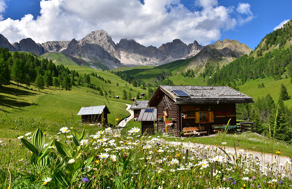
    Don’t miss: the traditional alpine huts of Valfredda overlooking the Focobon mountain group.

    * Hut closed summer 2026.

    Parking area near Malga Col de Mez

    Parking area near Malga Col de Mez

    8,3 km

    3 hours and 15 minutes

    Medium

    Suitable technical clothing and hiking boots

    VALT (Falcade center)-MALGA AI LACH

    Medium walk

    From the parking area in the hamlet of Valt, follow the road towards Malga ai Lach*, passing through spruce and larch forests along ancient footpaths, mule tracks and forest trails, until you reach Tabià de Valbona. From here, turn right and continue uphill along the forest road leading to the mountain hut. For the return journey, you can either retrace your steps or take an alternative trail that descends from Tabià de Valbona directly back to Valt.

    * Hut closed summer 2026.

    Parking area in the hamlet of Valt

    Malga ai Lach (closed summer 2026)

    3,7 km

    1 hour and 30 minutes

    Medium

    Suitable technical clothing and hiking boots

    COLMEAN-BAITA DEI CACCIATORI-COLMEAN

    Medium walk

    Start from the Colmean parking area and walk down the paved road to the hamlet of Feder. Here, take Trail n.687 on the left, which crosses the forest. At the junction with the trail coming from Forcella Lagazzon, follow the signs for Baita dei Cacciatori. Along the way, enjoy beautiful panoramic views over Feder and the surrounding valley. Once you reach Forest Road n. 689, continue uphill to Baita dei Cacciatori Hut. To return, follow Forest Road n.689 back to Colmean.

    Don’t miss: a taste of the typical local dish: casunziei with gamaite (pasta filled with alpine herbs).

    Parking area in the hamlet of Colmean

    Parking area in the hamlet of Colmean

    7 km

    3 hours and 15 minutes

    Medium

    Suitable technical clothing and hiking boots

    RIFUGIO FLORA ALPINA-CASONI DI VALFREDDA-FORCA ROSSA

    Challenging walk

    From Rifugio Flora Alpina, follow the forest road through the scenic Valfredda, crossing wide meadows, pastures and traditional mountain huts, until you reach the junction with the trail descending from Val di Forca. From here, continue left following the signs for Forcella Forca Rossa and cross the high-altitude pastures to reach the panoramic viewpoint at the saddle.

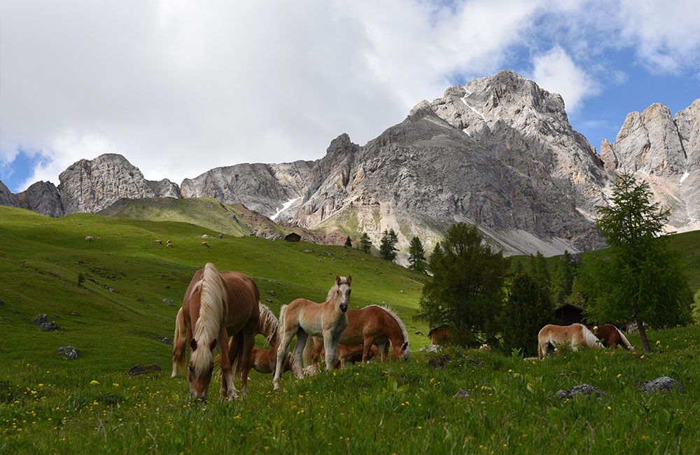
    Don’t miss: panoramic viewpoint at the saddle overlooking Valfredda, with its beautiful pastures and herds of grazing horses.

    Rifugio Flora Alpina

    Forca Rossa Saddle

    5 km (one-way)

    2 hours and 30 minutes (one-way)

    Medium-challenging

    Suitable technical clothing, hiking boots, a rucksack with water and some energy snacks and a windproof jacket.

    VALLES PASS-RIFUGIO MULAZ-CIMA MULAZ

    Challenging walk

    From Valles Pass, follow Trail n. 751 towards Forcella Venegia. The route initially crosses alpine pastures and grassy slopes, before climbing along a steeper section through scree and Dolomite rock. Once you reach the pass, a splendid panorama opens up over the Pale di San Martino and the Val Venegia. Continue on to Passo di Venegiota and Passo dei Fochet, then descend to the right and climb back up along a gully. The final 300 metres of ascent take place over typical alpine terrain, with a few short secured sections requiring sure-footedness and a minimum of experience, until you reach Rifugio Mulaz, 2571m. From here continue along path n.703 towards Cima Mulaz, tackling a final, steeper stretch which, however, presents no particular mountaineering difficulties. For the return journey, follow the same route back to Valles Pass.

    Don’t miss: once at the summit, enjoy a spectacular view of the main peaks of the Dolomites.

    Valles Pass

    Rifugio Mulaz – Cima Mulaz

    8 km (one-way)

    3 hours (one-way)

    Medium-challenging

    850m to the mountain hut, 1180m to the summit

    Suitable technical clothing, hiking boots, a rucksack with water and some energy snacks, a windproof jacket, a warm layer (even in summer) and charged mobile phone.

    MOLINO-RIFUGIO MULAZ-CIMA MULAZ (path closed summer 2026).

    Hard walk

    After passing Camping Eden, follow Forest Road n.722 towards Rifugio Mulaz (2571m). After about 2 km, continue along the trail that enters the stunning Focobon Valley. At 1894m you’ll reach Casera Focobon; continue left, crossing the Rio Focobon, up to the foot of the surrounding peaks and Rifugio Mulaz, located just below the pass. To reach the summit, continue for about one more hour towards the pass, then turn right towards Cima Mulaz (2906m).

    Don’t miss: the final push from Rifugio Mulaz to the summit for a breathtaking 360° view over the Dolomites – extending to the Venice Lagoon on clear days. Don’t forget to ring the summit bell!

    Path closed summer 2026.

    Eden Campsite, Molino

    Rifugio Mulaz – Cima Mulaz

    11 km

    4-5 hours

    1320m to the mountain hut, 1650m to the summit

    Suitable technical clothing, hiking boots, a rucksack with water and some energy snacks, a windproof jacket, a warm layer (even in summer) and charged mobile phone.

    LAGAZZON-COLMONT-LACH DEI NEGHER

    Hard walk

    Start from Rifugio L’Agazon (1356m), where you can park your car, and follow Forest Road n.687 to Baita Col Mont (1854m). Walk through wide meadows with stunning views of Monte Civetta and the Pale di San Martino. Continue along the scenic uphill trail to Forcella dei Negher (2286m), enjoying breathtaking views over the Biois Valley. Before heading back, take a short descent to Lach dei Negher (2205m), a beautiful glacial lake with striking colours.

    Don’t miss: Lach dei Negher, a fairytale-like lake steeped in Dolomite legends, where ibex are often spotted among the rocks and alpine meadows.

    Rifugio L’Agazon

    Lach dei Negher

    5 km

    3 hours (one-way)

    Suitable technical clothing, hiking boots, a rucksack with water and some energy snacks, a windproof jacket, a warm layer (even in summer) and charged mobile phone.

    MORE TIPS…

    GARES VALLEY-RIFUGIO ROSETTA G.PEDROTTI-CASERA CAMPIGAT

    Hard walk

    Start from the Pian delle Giare parking area, at the end of the Gares Valley and follow Trail n.704, passing the Comelle Waterfalls and the Comelle Gorge, the latter being an exposed section. Once past the Orrido, continue along the path which climbs up the Comelle Valley; the gradient is steady but presents no particular technical difficulties, and you will reach the Rosetta Plateaus (over 2300m) and the Rifugio Rosetta G. Pedrotti, situated in a panoramic spot at 2581m. The return journey can be made via the same path, or along path n.761, which passes through Casera Campigat, one of the area’s historic mountain pastures, and leads to Forcella Cesurette (this route includes an exposed section that requires caution). Continue down path n.756, which takes you back to the starting point in about an hour.

    Pian delle Giare parking area, Gares Valley

    Rifugio Rosetta

    Full-day round trip or circular route

    Suitable technical clothing, hiking boots, a rucksack with water and some energy snacks, a windproof jacket, a warm layer (even in summer) and charged mobile phone.

    VIVAIO PICCOLET-BAITA PIANEZZA

    Medium walk (challenging for the gradient)

    From the Vivaio Piccolet, start by following the forest track as it winds its way into the woods, climbing steadily. After covering the first section, you’ll reach a spring, perfect for a short break and leave the forest track to take a path that climbs steeply through the woods. The climb continues with a few hairpin bends, allowing you to gain altitude quickly, until you reach the edge of the woodland, from where you begin to catch sight, amongst the surrounding meadows, of the Baita Pianezza, situated in a panoramic spot from which you can admire the Biois Valley and the surrounding mountains. From here, you can continue on to Forcella Pianezza or head towards Sottoguda.

    Vivaio Piccolet, Vallada Agordina

    Baita Pianezza

    1 hour and 30 minutes

    Medium (challenging for the gradient)

    Suitable technical clothing and hiking boots.

    VIA FERRATA ROUTES

    Our website is not intended to replace specialist technical guides on via ferrata routes, but to offer you some useful advice so that you can tackle this experience with awareness, peace of mind and safety, whilst discovering the marvellous Dolomites.

    From the simplest hikes to the most challenging routes, the Dolomites offer an extraordinary variety of via ferrata routes for every level of experience.

    In any case, before setting off on your hike, we always recommend that you plan your trip carefully using a detailed map, check the weather conditions, ensure you have the right equipment, and, above all, be aware of your own physical abilities; you may also wish to contact a guide who can accompany you and help you enjoy a unique experience.

    To hire equipment, you can contact the Equipe Ski School in Falcade, which also offers a wide range of equipment for summer activities. The cost of the via ferrata kit is €30.00 per day and includes a helmet, harness, carabiners and a fall arrest device.

    VIA FERRATA “PAOLIN-PICCOLIN” – CIME DELL’AUTA

    Via Ferrata

    From Colmean, follow Trail n.689 past Baita dei Cacciatori and Baita Giovanni Paolo I (currently closed). Continue through the forest to the start of the Paolin Via Ferrata, which climbs to Forcella del Medil and leads to the summit cross of Cima d’Auta. For the descent, you can either return via Lach dei Negher and Lagazzon, or follow the equipped route back towards Colmean.

    Colmean

    Cross at Cima d’Auta

    10 km

    6-7 hours

    Via Ferrata

    Suitable technical clothing, via ferrata equipment, hiking boots with suitable soles, a rucksack containing water and some energy snacks, a waterproof jacket and a warm layer (even in summer), a fully charged mobile phone (preferably with a power bank)

    GARES-VIAZ DEL BUS-MALGA VAL BONA

    Via Ferrata

    From the parking area at the end of the Gares Valley, follow the Trail n. 704 past the Comelle Waterfalls and the Comelle gorge (Orrido delle Comelle) to Pian delle Comelle. From here, take Trail n. 756 (Viaz del Bus), featuring an equipped section and a distinctive natual hole in the rock. Return via Malga Valbona and follow Trail n. 756 back to the parking area.

    Note: via ferrata equipment is recommended.

    Pian delle Giare parking area, Gares Valley

    Pian delle Giare parking area, Gares Valley

    10 km

    4-5 hours

    Via Ferrata – short equipped section

    Suitable technical clothing, via ferrata equipment, hiking boots with suitable soles, a rucksack containing water and some energy snacks, a waterproof jacket and a warm layer (even in summer), a fully charged mobile phone (preferably with a power bank)

    VIA FERRATA BEPI ZAC

    Via Ferrata

    From Passo San Pellegrino, take the chairlift to Passo delle Selle. From here, follow the Bepi Zac Equipped Trail, a spectacular route featuring trenches, tunnels and World War I military positions. From Forcella Ciadin, return to the starting point along Trail n. 637.

    Passo delle Selle (accessible by chairlift from Passo San Pellegrino)

    Forcella Ciadin

    14 km

    6-7 hours

    Via Ferrata

    Suitable technical clothing, via ferrata equipment, hiking boots with suitable soles, a rucksack containing water and some energy snacks, a waterproof jacket and a warm layer (even in summer), a fully charged mobile phone (preferably with a power bank)

    You don't have permission to register