 Webcam
 Weather
 Lifts
Lifts Bike Trail
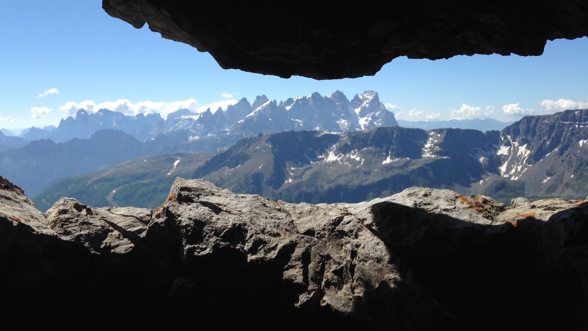
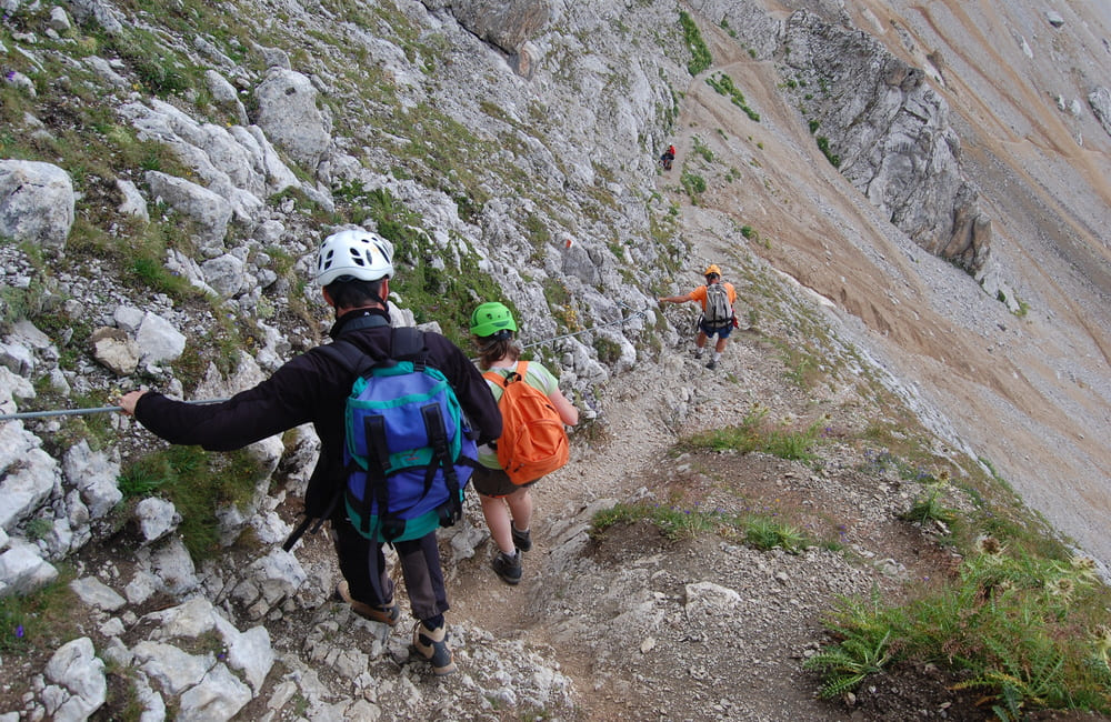
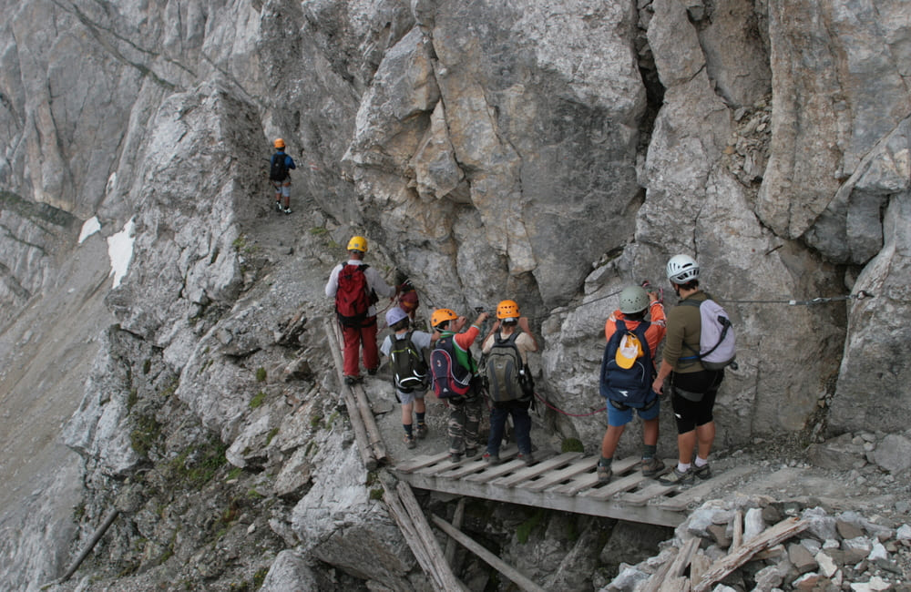
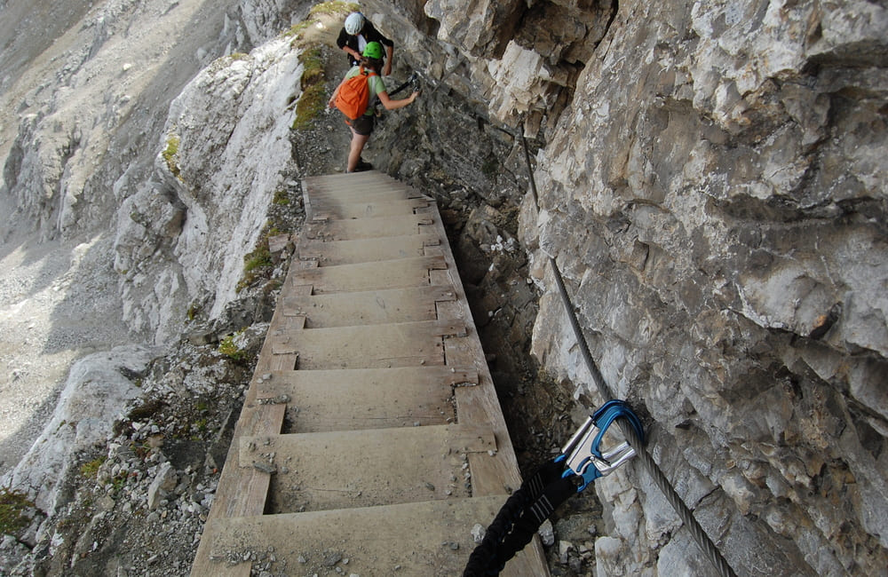
Via Ferrata
Our website in no way seeks to replace more specific, technical sites on the via ferrata equipped climbing routes, and aims simply to offer you a few suggestions on how to tackle the discipline with peace of mind and in safety, for some literally hands-on experience of our beautiful Dolomites.
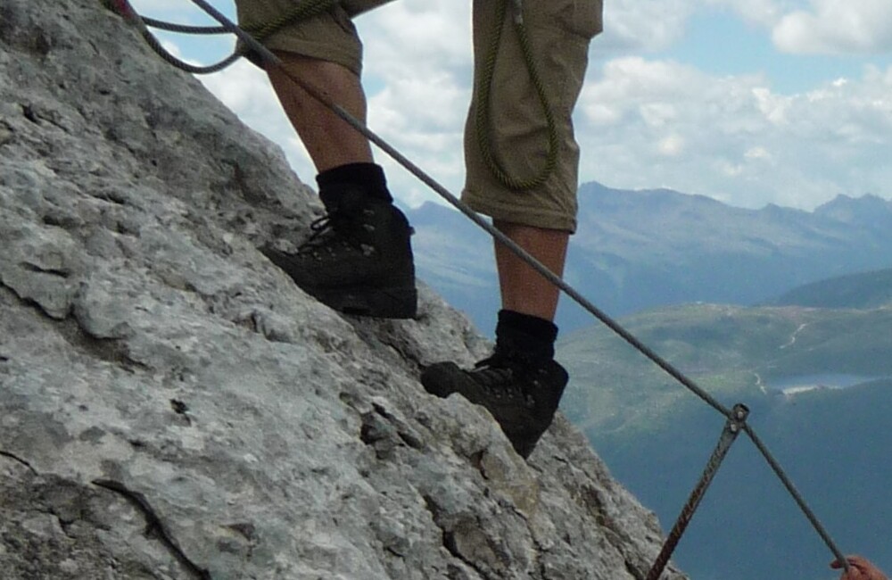
A via ferrata (literally, iron path) is composed of structures and equipment created and placed artificially on a rock wall to make it safer to climb as part of a trekking/mountaineering route.
For this equipment to be helpful for you to make your way onwards and upwards in safety, it is essential to follow a series of behavioural rules and indications for the use of adequate technical equipment.
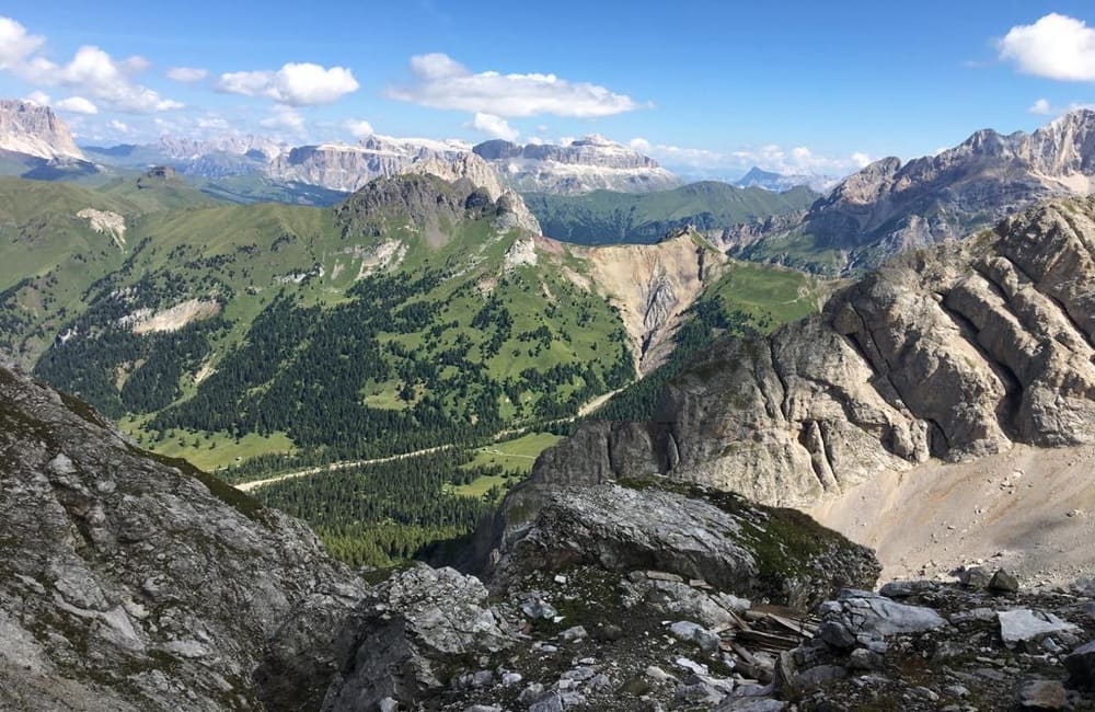
The Dolomites offer numerous vie ferrate, from simple to much more challenging.
In all cases, before setting out, we always advise you to plan your trip carefully, with the aid of a detailed map, to check the weather conditions, to ensure you have the right equipment, and above all, to be aware of your own physical abilities and to contact a guide who can accompany you and ensure you have an unforgettable experience.
For equipment hire, you can contact the Equipe Ski School in Falcade, which also offers a wide range of equipment for summer activities.
Cost of a complete set per day €20: helmet, harness, karabiners or quickdraws, gloves.
For the contacts of the Equipe Ski School, see the dedicated page.
ALTA VIA BEPI ZAC
From the Costabella chairlift to the Forcella Laghet saddle
Alta Via Bepi Zac is a particularly interesting itinerary from a historical and landscape point of view, along which you can see the remains of the Austro-Hungarian army trenches and emplacements from the First World War. It runs along the rocky ridge from the Selle Pass to the Forcella Laghet saddle, in the Costabella Group.
The itinerary includes a number of equipped and exposed points that require particular attention, although long stretches of the first half of the route could be considered easy.
Park at the area next to the Costabella chairlift at the San Pellegrino Pass. Take the chairlift up. An easy stretch of path 604 will take you to the Selle Pass and the Selle Refuge, at an altitude of 2530 m. This is the departure point for the equipped route that will take you up to the 2759 m altitude of the Cima di Costabella peak.

ALTA VIA FEDERSPIEL
From the Costabella Chairlift to the Forcella La Costela Saddle
Alta Via Federspiel is a particularly interesting itinerary from a historical and landscape point of view, along which you can see the remains of the Austro-Hungarian army trenches and emplacements from the First World War. It runs along the rocky ridge from the Selle Pass towards Cima Malinvern, in the Monzoni Group.
The itinerary includes a number of equipped and exposed points that require particular attention, although long stretches of the first half of the route could be considered easy.
Park at the area next to the Costabella chairlift at the San Pellegrino Pass. Take the chairlift up. An easy stretch of path 604 will take you to the Selle Pass and the Selle Refuge, at an altitude of 2530 m. This is the start of equipped route no. 616, which climbs up to the 2630 m of the Cima Malinvern peak and on to the Forcella La Costela saddle before descending through the Val Pasmeda to I Ronch, where you will need a car to take you back to the parking area.
Costabella Chairlift
Forcella La Costela
Total duration of the route : 6 hours
Mainly rocky
Medium
VIA FERRATA PAOLIN-PICCOLIN AT CIME D’AUTA
From Colmean to the Cima d’Auta Orientale Peak
Via Ferrata Paolin-Piccolin is a classic itinerary in the Agordino area, and the Cime dell’Auta peaks are very much an emblem of the area around Falcade/Caviola. The rather challenging approach path starts out from Colmean (1300 m), and passes by the Baita dei Cacciatori mountain hut, the Papa Giovanni Paolo I Bivouac and on up to the start of the ferrata. Along the first stretch are two vertical ladders to help you across the first rock leap, after which the via ferrata route becomes easier. This route rewards the hiker with a splendid climb, fabulous views and a delightful landscape. The main destination of this itinerary is the Cima dell’Auta Orientale peak, at an altitude of 2624 m. On the way back, there is an optional variant that runs across the Forcella dei Negher saddle, which can also take in the Lach dei Negher lake.
If you feel you need to stop off along the way, you can do so at the Baita Papa Giovanni Paolo I mountain hut, which is equipped for overnight stays (please respect the hut and the surrounding environment).
Colmean
Cime d’Auta
7 hours
Difficulty level: medium/challenging Good level of fitness required.
VIAZ DEL BUS EQUIPPED PATH
From the Capanna Cima Comelle refuge
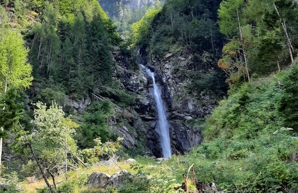
A very attractive equipped route that runs through some delightful landscape, including the Garés Falls, the Orrido delle Comelle gorge, Pian delle Comelle, and Viaz del Bus itself, which gives its name to the itinerary.
Park in the area in front of Capanna Cima Comelle, at an altitude of 1333 m, and make your way along path no. 704 past the waterfalls and the Orrido delle Comelle gorge and on towards Viaz del Bus (approx. 1800 m). Some stretches are exposed, but well equipped.
The return route is via Casera Valbona and the Teaz refuge until you come back to Capanna Cima Comelle.
VIA FERRATA FIAMME GIALLE TO PALAZZA ALTA
From the Bastiani neighbourhood of Cencenighe to Palazza Alta
Very long, tiring route, with a very difficult via ferrata, recommended only for experienced hikers in good physical shape. Very lengthy, challenging return route, which involves having to start out along the via ferrata early in the morning.
The route starts out from the neighbourhood of Bastiani, at an altitude of 971 m, in Cencenighe Agordino.
Follow path no. 562, which leads, in about an hour, to the start of the first stretch of the via ferrata. The route becomes increasingly difficult as it progresses to the final peak, at an altitude of 2255 m. It takes 4/5 hours to reach the peak. On the way back, you can either head towards Bastiani, following the sign for i Sech, or towards the Vazzoler Refuge (which will take about two hours’ walk) and then continue towards Capanna Trieste and go down the valley towards the village of Listolade (from here you will need a second car to get back to the start of the itinerary).
Bastiani neighbourhood of Cencenighe
Listolade
about 8/9 hours
Very hard

ALTA VIA DELLA MARIOTTA
From the Col Margherita cableway to the Forcella Juribrutto saddle
Go up to the San Pellegrino Pass and park in the area in front of the Col Margherita cableway. Take the lift up to the top of Col Margherita (2530 m). The route continues regularly along a ridge, with a few equipped stretches, towards the Forcella Vallazza saddle, and then on towards the Forcella Juribrutto saddle, at an altitude of 2381 m. During this route along the ridge, you will come across interesting traces of the Great War, including barracks and the remains of barbed wire and trenches.
Continue on path no. 628 towards Col de le Palue (2260 m) and the Malga San Pellegrino alpine hut, and then complete the return journey by car.
Funivia Col Margherita
Forcella Juribrutto 2381 meters
6 hours
Easy